
Spring is only 13 days away which means we are in full planning mode for the 2019 field season. This month we’d like to share a little deeper insight into some projects for this field season including SeagrassNet, freshwater and estuarine water quality, and seaweed monitoring. You can always check out our video series, “Ask Our Scientist,” for an overview of where our data comes from and how some of it is collected. Have a specific question you’d like us to answer? Send your ideas and questions to PREP’s Coastal Scientist, Kalle Matso by email (Kalle.Matso@unh.edu).

SeagrassNet
SeagrassNet is expanding in the Great Bay Estuary. This is great news for those concerned about ecological health in our estuary, because seagrass is a key species and SeagrassNet will offer more detailed data on the health of this habitat.
SeagrassNet is an internationally accepted protocol for monitoring change in seagrass habitats. A SeagrassNet site uses three permanent 50-meter transects at varying depths, and various parameters are monitored along specific locations at each transect multiple times a year.
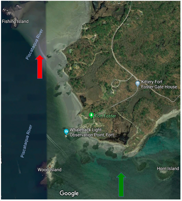
The new site is planned for Portsmouth Harbor and will be located near Fort Foster in Kittery, Maine. This new site will become the second site in the Great Bay Estuary, joining the Great bay site, located near the mouth of the Lamprey River. The two sites will be monitored by a team from the UNH Jackson Estuarine Laboratory, led by Dr. David Burdick.
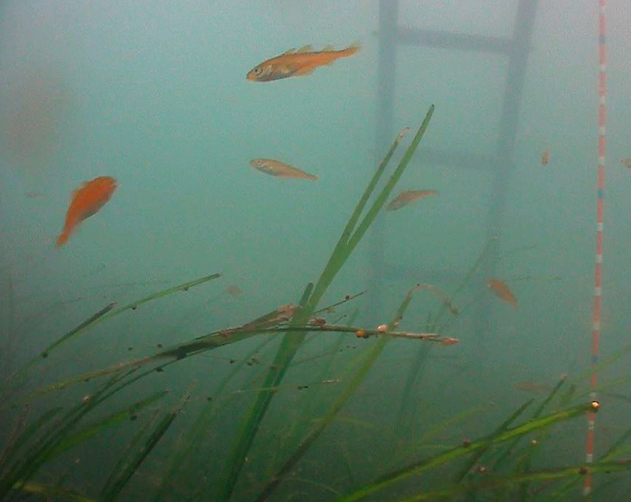
Seagrass – our local seagrass species is known as eelgrass – has been in the news a lot over the last decade due to concerns about its decreasing health and resulting impacts on our ecosystem. Eelgrass habitat provides many critical services such as primary production, a nursery for commercial and recreational fish species, carbon sequestration, and stabilization of sediment.
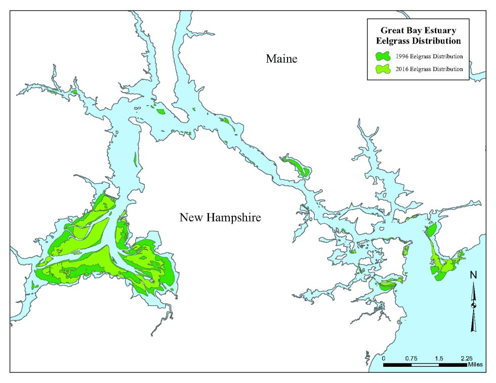
While we have consistent data on the number acres with more than 10% eelgrass coverage—that is, the distribution of eelgrass—we have been less consistent in monitoring indicators of eelgrass health, such as: density of eelgrass plants, length of shoots, biomass, etc. These are the parameters captured with the SeagrassNet protocol. Coupled with distribution data, this will give managers greater insight into the health of eelgrass and may help us answer questions related to why we are seeing the trends we are. (Eelgrass distribution is currently around 1,600 acres, compared with 2,900 acres at its peak distribution in 1996.) Click HERE to learn more about eelgrass in the Great Bay Estuary in the 2018 State of Our Estuaries report.
Other 2019 Field Season Highlights
Estuarine and freshwater water quality measurements will continue in 2019 as in previous years. With regard to estuarine stations, grab sampling—physically taking water samples back to the lab for analysis—as well as automated datasonde measurements will occur at 11 stations, including a station in Hampton Harbor, active since 2017.

Our partnership continues to expand its efforts to better understand seaweed dynamics, entering its second year of monitoring subtidal seaweed to go along with the intertidal seaweed monitoring that has been happening annually since 2013. This year, we are also working to pilot new drone technology. Drones hovering at 200 feet can capture high-resolution images that can complement observations from the boat as well as images captured from aerial surveys, usually captured at approximately 3,000 feet. One advantage of using drones is that they fly below clouds, which offers greater flexibility in terms of sampling days.
There are many other indicators being tracked by the Partnership. Interested in learning more? Feel free to contact Kalle Matso for more information. You can also get involved with PREP’s Technical Advisory Committee and its workgroups.